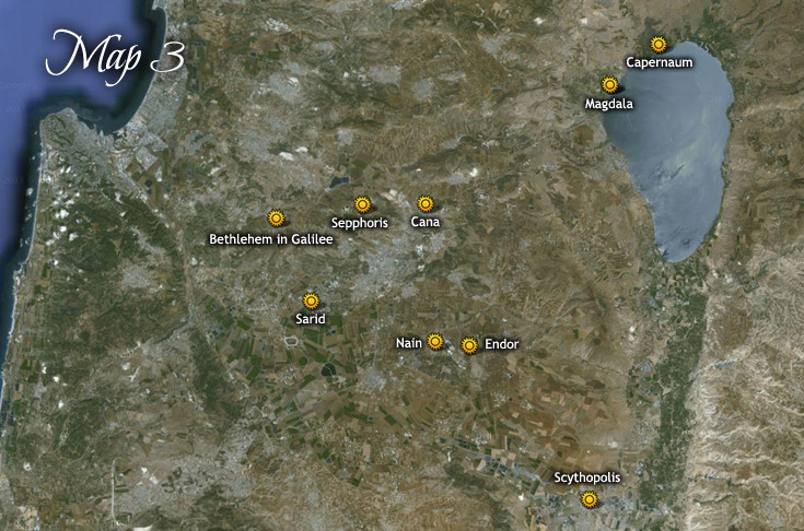
Map 3: Visits to towns around Galilee by Child Jesus October 4, 4 B.C. ~ June 3, 3 A.D. Map 2 | Maps Index | Map 4 Image Location Reference Google Map Link Sarid 123:1.7 32.662067,35.226631 Bethlehem in Galilee 123:3.8 32.73441189566795,35.19021456945647 Magdala 123:3.8 32.84673276947773,35.52445049880779 Capernaum 123:3.8 32.88049529963555,35.57293371387502 Cana 123:3.8; 124:1.12 32.74603042943924,35.33930751606621 Endor 123:3.8; 124:1.12 32.62648833183192,35.38382380295226 Nain 123:3.8; 124:1.12 32.63010979466632,35.34923855119784 Sepphoris 123:3.8; 124:1.12 32.7456557285354,35.27657981749804 Magdala 123:6.1; 124:1.12; 124:3.1 32.84673276947773,35.52445049880779 Scythopolis 124:3.7 32.4964494109699,35.503754030697 Book traversal links for Map 3: Childhood of Jesus—Locations of Places Visited