Map 2: Childhood of Jesus—Locations of Places Visited
October 4, 4 B.C. ~ June 3, 3 A.D.
Map 1 | Maps Index | Map 3
Image
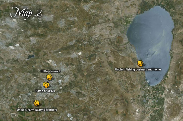
| Location | Reference | Google Map Link |
| Hilltop lookout | 122:5.9, 122:6.2, 125:4.2, 126:1.1,2, 128:7.2, | 32.71726666644359,35.30390000023258 |
| Uncle's Farm (Mary's Brother) | 123:1.7 | 32.65719999957002,35.26886666635727 |
| Uncle’s Fishing Business and home | 123:6.1 | 32.74990738480606,35.55448596019799 |
| Home of Jesus | 122:5.9,122:6.2, 122:6.3, 123:3.1, 123:3.4, 123:4.4, 123:5.15 | 32.7003,35.294733333333 |